
 The Flinders Ranges is a very special place. A geological wonder on display with secrets hidden in plain sight. The mere sight of it’s majestic and proud sculptures contrasted against the vast Aussie azure, will silence the most hardened city dweller.
The backbone of the Flinders rises out of the endless flatness of the Eyre and the Willochra. Worn by the passing of time and the elements, the ranges are a mere shadow of what they once were. Even so, the dramatic remains are still impressive standing tall and proud.
 Most however, will look but not see. If only those would stop for a moment to marvel and wonder at how this geological masterpiece came to be. Even some of the ancient local rock art is unknown to the more recent inhabitants. You know, the ones who have been here for the last 40,000 years or so.
Our last walk takes us to the end of the Heysen trail at Parachilna Gorge, and like all journey’s, is looked on with great anticipation, but this one also with regret. Regret, that by the end of the day, our many years on this journey will be finally over.
 We kept to “business as usual” for this walk. Prepping all our gear, food and water the night before. Even so, we ended up managing to forget some things. Seems to be innately human to miss something, or perhaps I am just not quite as clever as I think I am.
The following morning we rose well rested and after a hearty bacon and eggs breakfast (Heysen Trail traditional), we set off once again to play with the Kangaroo’s and the rabbit’s. The morning parade of Kangaroo’s was at it’s best this morning, with mobs left right and centre. Very sensible they were though, giving us room to pass with no harm.
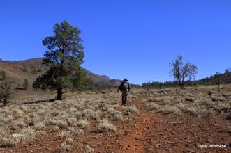
 Another perfect day in the Flinder’s was dawning as we neared our starting point. The sun had breached the far off horizon while the cool breeze freshened up our early morning languor. By the time we got our selves organised the bright sun stood alone in the bright blue, “big” Australian sky. We were now about to commence our last walk to complete the Heysen Trail. We paused for a moment to suck in the occasion, standing amidst the weathered hills and majestic mountains, as well as the old Eucalypt men of the Aussie bush. We were apparently still chilled from the early morning air it seems.
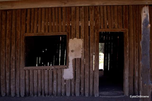
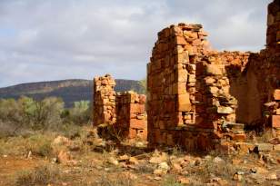
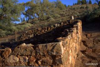 Wandering up the small rise on our start we checked the ruins of Aroona before heading off proper on the trail. The gentle open trail we started on is a little deceiving and is not indicative of the full walk ahead. Although not challenging in gradient, it is quite long and very rocky in parts. The trail is also not well marked in the creek we were to walk in.
On our left, the ever commanding Heysen Range towered above us. As if sitting on a throne watching it’s pilgrims pass by in a never ending parade of obedient subjects. We silently payed homage as we passed by. The “junior” ABC Range on the right was still big enough to command some respect also. We humbly walked on, in the shadow of both giants.
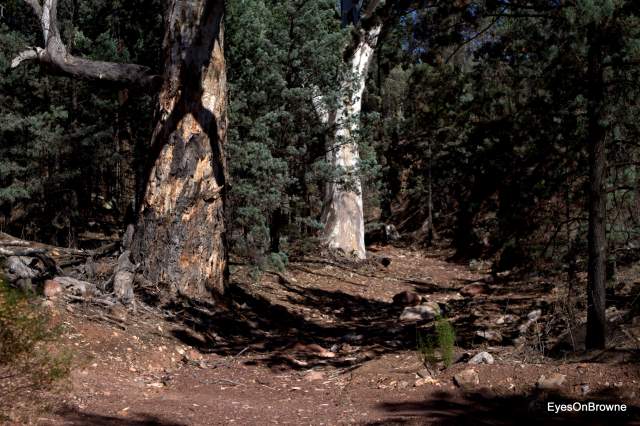
 A bit up and down for the first six kms in open woodland with plenty of Pines eking out an existence in red rock of the Wilcolo sandstone. Our trail slowly dragged us up hill 200 metres topping out at 585 mtrs above sea level. After that it was all down hill. Almost. Good smooth track. Then rocky track. Good smooth creek, and then rocky creek.
The trail wound it’s way through the open woodland, in and out of the creeks until our final crossing of Five Mile Creek. Leaving the creek we headed up hill to the right. The trail markers progressively becoming more sparse as we headed into the next gully.
 The trail now basically followed Wild Dog Creek, however we were mindful that a “hard left turn” was coming up further along, and as it happened my GPS had run out of charge and guess what items I’d forgotten to bring? Yep the spare batteries. With my GPS now flat we had to re-acquaint ourselves with some old fashioned orienteering with the map. All seemed fine for quite a while, in spite of the fact the Heysen signs had left us. We knew we would be following Wild Dog Creek for no more than about 3km’s before turning, so when we hit the 3k mark we stopped to assess our lack of Heysen Trail signs.
 It appeared that the hard left turn had eluded us at some point “back there”, and we were off the trail and still in the creek. We knew pretty well where we were but had not seen any trail markers for the last kilometre or so. A quick scan of the map and the immediate terrain gave us our likely location and off we went up the rise to the left, meeting the trail again having only missed it by a smidge. Ps the “hard left turn was in actual fact a gentle left. The creek turns right and the trail goes fairly straight.
 Once over the rise and into the final gully, the last section (as always) seemed to go on for just “ever”. “Surely this next corner/rise should reveal the end” I said many many times. Rocky creeks are always tiresome and this one was no different. Finally seeing signs of the end(“see I told you it was around this bend”), Grant strode off confidently while I paused to take a few pictures and soak in the moment. Delaying the finality of our journey just a little while longer.
Triumphant at the end, we breached the stairs with a whoop and a yell!
Or, did we?
I’ll leave you all with three possible endings to our “most excellent” Heysen adventure.

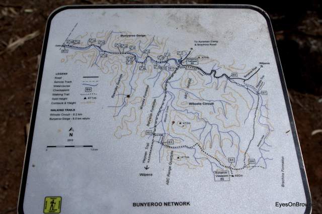
Distance: 19 kms
Speed: 5.1 kph
Terrain: Wide track and rocky creek walking.
Altitude: 194 metres up hill, and 330 metres descending to the end.
And a few more sights……

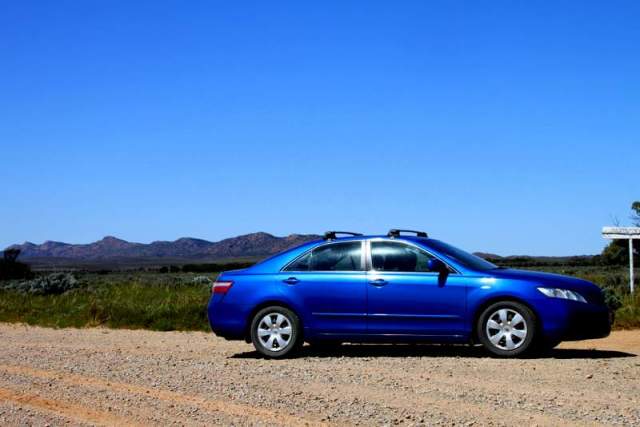
That lovely sight of my car at the end of a walk. Always means a cold beer.


Aroona ruins


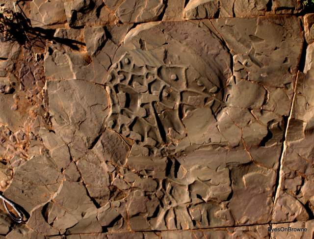
Wilcolo Sandstone


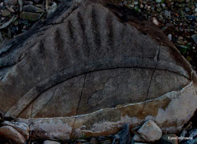
Would have loved to see the water that did this.


Token offerings for the Heysen Trail Gods?


RGB
 “Here Comes The Sun” sang softly to me from my phone, waking me from my slumber. The night had not been restful though. Wave after wave of Flinder’s Mosquito’s dive bombed me every ten minutes or so. Just enough to disturb my attempts at sleep, and when I did manage my way to unconsciousness, I awoke soon after with throbbing bites the size of almonds. 5AM finally finished the Mozzie onslaught and I arose in a stupor, keen to take on the day. Anything to remove myself from this Mozzie nightmare.
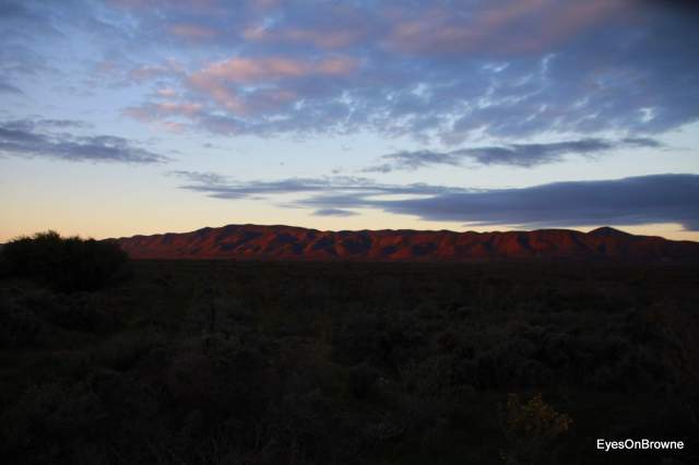
 With the sun yet to make an appearance, we headed off towards Brachina Gorge. Today’s walk will be Terezona to Aroona Hut. On the road we ran the gauntlet of kangaroos and rabbits skitting across the road all the way to the trail head. The pre dawn drive was interesting with kangaroos feeding along the roadside and many sitting on the road with little intention of moving along very quickly. Our strike rate for today would end up being “zero”. Quite amazing considering the dozen or so Roo’s every kilometre. The Heysen Range standing proud with it’s striped bands of glowing ochre in the early morning sun as we headed north to Aroona Hut.
 Quite an easy going track in the undulating terrain amongst the native pines and the wattle, with Emu’s and Kangaroo’s a plenty. The Roo’s maybe a bit shy, but the Emu’s are still pretty dopey.


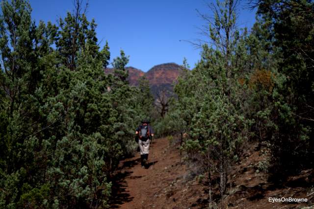


 With mist cascading over one of the Wilpena peaks, the early morning sun bathed the ridge in a warming glow. All while we strode on through open grassland in the chilled morning air. The cypress pine’s slowly grew before us, filling our view. We were soon immersed into this native forest which would be our friend for many a kilometre.
 The first part of the walk peaked at about 57 metres, before we started a long slow descent, albeit a bit up and down. A very easy walk amongst the pine trees, and the path of red Wilcolo sandstone was at times just like a manicured city park path.
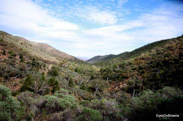
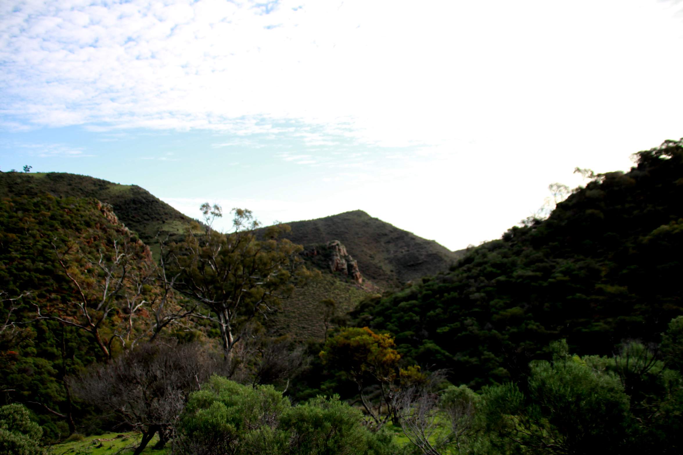
 We followed the creek for a way before heading up the substantial hill. The moderate climb on a narrow trail got the blood pumping and cresting the hill we rejoiced in reaching the top. Looking into this new valley, we stood and pondered. Somewhere down there was our finishing point for the day.


 Sunny day, but with plenty of scattered cloud, which would persist all day. With a nice cool breeze, this made it a perfect day for walking in the Flinders.
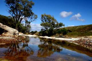 Water is always a rare sight up here, and it still amazes me that there are tadpoles a plenty in the remaining pools. Where do the frogs go during the many dry months? Life is truly amazing.
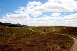 We wandered on in the bright sunshine, refreshed with the chilled breeze. All external senses engaged, while the mind quiet and still while we drifted through the landscape.
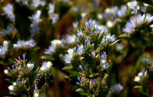
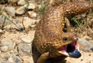 Life abounds out here at the moment. From grasses, and wild flowers, to all manner of six and eight legged warriors, and of course the stately and confident lizards. Do I have to mention the Kanga’s, Emu’s and a vast variety of birds? My favorite though (sorry Stumpy), was the Bearded Dragon. What a beautiful creature! Too cool to even be bothered by us.
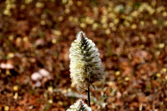
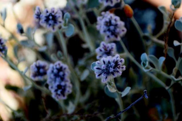
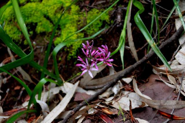
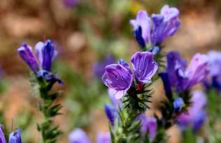 Patches of white were splashed carelessly about by Mother Nature’s artist, with the occasional curse of the Patterson, only finding salvation in the arms of Jane. In spite of it’s reputation, purple looks good in any environment.
 A shortish walk up the hill and around a couple of bends before we arrived at the gate of our relief. The beer was especially cold today, as we shared our company with the smallest of lizards. As we sat at our table of recovery and satisfaction, two Skinks cavorted about for our entertainment.
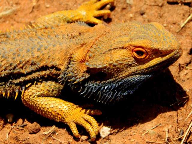


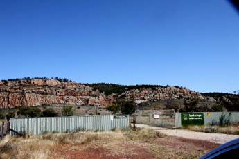 A coolish and cloudless day greeted us this morning. Certainly much cooler than the usual October weather in the Flinders. The road to our start point had plenty of furry and feathered friends greeting us along the way, slowing our journey at many a point. Mostly Kanga’s who seem to want an early morning race. One hitting 44kph! Just a young’n too. Leaving our friends, we kicked up a trail of dust leading to the gorge. The rock face stood large in front us. An amazing rock sculpture that is Buckaringa Gorge.
 Lizards feature quite regularly on our two walks this trip. Lazing in the sun seemingly without a care. Right in our “boot scootin” way on the trail. Until we get too close of course.
 Seems to be a very healthy ecosystem out here. The recent rains have transformed the normally dusty grey landscape into a myriad of colours. Muted greens, browns and ochre bleed into each other, just like a Monet painting.
 socks.
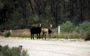 A couple of wild goats welcomed us into the second gorge, but did not stick around to chat. The goats headed off into the scrub while we climbed the stile to the right and after a short rest at the camp site, we headed up the first of the two major hills. About 50 metres each. Nice views from the top, and even though there has been plenty of rain with the recent storms, it does not take much time for the land to dry out. This was evident today.
 Off in the distance we could see a break in the landscape. A lighter coloured crescent splitting the land in two. It became apparent soon that we would be heading straight towards this oasis in our muted Monet landscape.
 Must be water in the creek I thought, or that jumbo of the bird world must be really lost!
 A couple of K’s later and after crossing Kanyaka creek, we hit the road. Although the walking was a little easier, the hardness of the road and the increased heat was starting to take it’s toll. Even though the road walking was only 4.5kms, it seem much longer and harder. Why is it that the last few K’s always seem to be the hardest. Strange that.


 The night before our walk, Malcolm was doing his best to warn (or scare) us about the walk through to Eyre Depot. He had heard many a tale of heart ache and tears, so just in case there was a smidge of truth to his tales, we decided to leave a little earlier giving us sufficient time for any unforseen outcomes. (code for stuff ups and slip ups).
 The five K mark rescued us from the creek and we headed up the hill above 500 metres. Up another hill, and up another hill, until finally atop the ridge which would take us all the way to Mount Arden, 12 K’s in from the Gorge.
 The ridge meandered left and right and up and down a little, before the final push up above 800 metres, to the summit of Mount Arden. At the top the wind was even more intense and absolutely relentless. It was only a short stay at the peak, to catch our breath and snap a few photo’s, before descending down the southern slope back to a more tepid temperature.
 Just after we saw horizontal ground again, the terrain opened up to a lazy creek with majestic old Gum’s and what looked like manicured lawn area’s either side. Every bit the public city park, but smack dab in the middle of the bush.
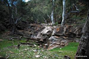 We headed off again refreshed, and wandering along the idyllic creek setting, we were easily lulled into the comfort zone in these gentle surrounds.
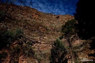 Just when we thought we were nearing the end, the trail took us up the side of a very steep hill. So steep it had rope to hang onto. Great view at the top, but at this point we were a bit shagged to really care too much. Once back in the creek we meandered our way through the canyon until coming to a rather steep waterfall. No water flowing over it, however it was much too steep to climb down, so we back tracked to where the trail actually
  leads up the hill and around the falls.


 We arrived in the dark on a dusty red track with thick scrub all around. An old blue tractor lit up in our headlights as we came upon the open grassy spread at the Homestead. It was only in the early morning light on the following morning that the dark veil was lifted revealing the oasis that is the


 Vague memories flood back as we wander the trail. Mostly not memories at all, just feelings and sensations of familiarity. A sense of comfort. Like coming home after a long journey. The connection through time though, cannot be explained, only experienced. The heart of this land clearly lives within me. Though I only dwell in this reality for short periods of time, my soul appears to be connected to the land.
 On the narrow path on the side of the hill, I travelled back in time. Once again amongst my peers from Seacombe High. Our very fashionable 70’s gear seeming out of place in this environment, but also, just out of place! But a sense of wonder, along with blissful ignorance of youth made this a great time.
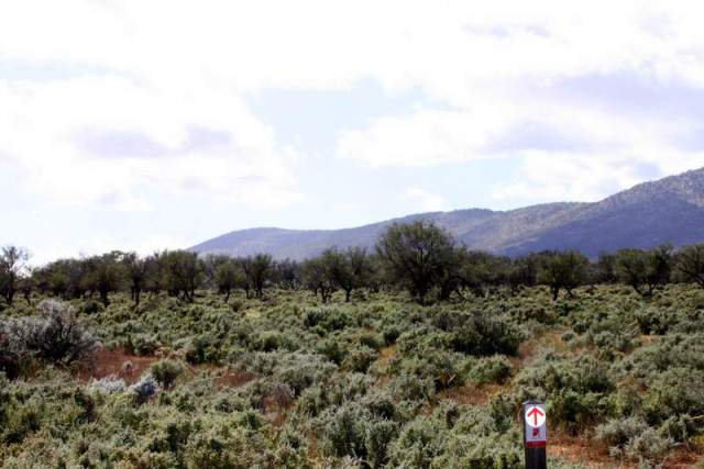
 We paced steadily up the hill, stopping briefly at a ridge or two to catch our breath and admire the steadily expanding view. The track to the top is a little vague at times along this section. In scrubby bush, we meandered on and off the trail, keeping a keen eye on our GPS. Looking back at one stage I noticed something a little different about one of the Heysen signs I had just passed. Ordinarily, the arrow points up to indicate straight ahead, yet this one was pointing straight down. Intentional or not, I loved the humour of the directional indication.
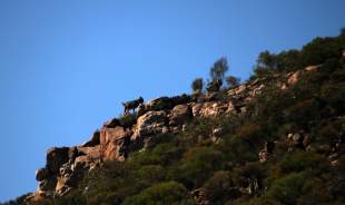 Breaching the top of Bridle Gap, with the entry to the park boldly etched in the space, we paused to reflect on our journey from the Elders. Mount Alec and the receding ridge standing tall in our view. It only seemed like yesterday that, ….. Oh that’s right, it was just yesterday.
 Off again after a short break, with the environment changing around us. Scrubby trees slowly giving way to taller native Pines, and eventually stately Gums dispersed in the manicured grassy land. Lazy Kangas and Wallabies not fussed by our presence, with only the slightest of a stoic glance, soon return to their languid tasks.
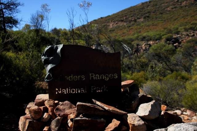


 Today will be a big day. 30 kilometre walk with a 1.5 k walk in through Mayo Gorge. Walking past the majestic Elder Range, we will be trekking through the amazing Arkaba Station. Stunning views, ever changing geology and plenty of wildlife. We will end up at Moralana Drive in between two Titans of the Flinders. Elder Range and Wilpena Pound.
 Feeling a little pensive about our walk today though. I was not feeling particularly well yesterday and with the pending 30 kms through some pretty remote country side, I was not feeling as confident as usual. We were well prepped though, with a days rest before and carrying extra gear and water for any unforseen events. My good lady had also given me some sound advice if we get lost and run out of food. “Eat Grant first” she said. My wife the ultimate survivor!
 Fear though, is a funny thing. It is always important to take note of your feelings, but check that the fear is based on something real, and not just an irrational thought. Clearly I was just feeling a bit off, as once we actually got going, all seemed to be ok.
 A Wedgy perched atop a nearby hill watched intently as we passed by. Waiting, I am sure, for us to stumble and fall, so he could pick our bones clean. A song popped into my head just at that moment, “The Holy Grail”. That particular line, “And those big black birds, they were circling in the sky”. (Betcha you are singing it right now too). Kinda felt appropriate with the Wedgy watching and waiting, as well as the fact we are on a quest for our own “holy grail”. It stayed in my head for quite a few k’s.
 The left hand turn out of the creek was always going to be hard to find, so we kept a keen eye on our distance travelled, and the map. A bloody big fat old Gum with a very little Heysen sign marked our exit from the creek. A short break was in order before venturing up the hill though. We were not looking to break any speed records today. Into Arkaba Station we went. Over the hill and following the track for a while before taking a right down the hill and into a creek again. This time it was Slaty Creek.
 A young bearded dragon narrowly escaping a hungry crow, while we narrowly miss walking into a massive Orb weaver strategically strung across our path, just waiting for a delirious Heysen Trail walker to stumble in. Face height, I came to within 20 cms of wearing this very ornate eight legged face jewellery.
 Slaty creek and into a feeder creek heading the wrong way. Took us 30+ minutes to work out what happened and to get back on track. Very easy to get lost in this hilly landscape. They all look the same. Even checking our direction was no help as the creeks meander from west, to north, then to east again in every kilometre.
 I started hearing voices at one point, and in this sacred landscape, thought my spiritual ancestors were breaking through to speak to me, but alas, it was just Red Range camp site, and there was a quite a group. Chatting and having a great time. Now, ordinarily we would be stopping for a chat, but no time to waste today. With this being only our half way point, we picked up the pace.
 Perfect place to pull up a rock and rest our bunions. The hills we now traversed were comprised of compacted red stone chips, which were devoid of all but the hardiest of plants. How the hell does anything grow in this stuff?
 Every thing at peace, except maybe for our taste buds. The crisp bite from that first sip of amber joy, ruminating throughout my body in repeating waves. Ahhhhhhh.


 Day two in the Flinders Ranges. Crisp cool morning. Clear blue sky. I noticed a couple of clouds to the west just as we drove into Mount Little Station. A reminder of the previous days weather. A lovely spot for camping here at MLS, and Kate whom we had the pleasure to meet, greeted us with typical country hospitality. MLS is the closest accessible road to the Heysen Trail on this section, so here we are. Mike picked us up at the end of the road near Mayo’s Gorge, returning to Leigh Creek Road for the start of our walk. Ps. Thanks Mike for both days drop off’s.
 (Leaving the old wagon, we climbed the stile and headed off on the trail, only to take a short break at the original Wonoka homestead. Beautiful stone work with a myriad of colours, with the Yourambulla Ranges in the back ground providing a memorable connection to todays story.
 Once in the creek, we turned north, up-stream, or so we thought. Funny how your senses can occasionally deceive. We were on the trail, but we thought we were heading up stream. Quite clearly the river bed was telling us something quite different. Dead trees and debris on the oncoming side of the river trees, and a sand bank on the trailing edge. Clearly we were heading downstream. It just did not feel like it.
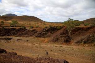 We wandered in and out of the creek, where ever the path looked easiest. The Heysen trail follows the creek all the way to Mayo’s Gorge, so little chance of losing the trail. Except maybe for the spot that Wononka Creek takes sharp left, with a feeder creek going straight ahead. Could have ended up in the Wide Ranges.
 Beautiful country with Gums along the river and plenty of green salt bush filling in the surrounds. Still a few skittish Emu’s and Kanga’s not being particularly sociable, heading for the hills at first sight. Did I put on deodorant this morning? Starting to wonder.
 Mayo Hut was well appointed, with bunks (with mattresses), a fire place, and even a “loo”. Oh what luxury! Being at Mayo’s hut means that we are almost done. Another couple of “K’s” and we exit through Mayo’s Gorge where Grant’s car is waiting with a nice cold beer. The Gorge was lovely, although lots of jaggard rocks to walk over at the start. Once at the car, we propped up the chairs, cracked open a beer, and just took in the the majestic Elder Range in the late afternoon sun. Cheers Grant.


